Pour vous qui comme moi prévoyez skier au Japon cette hiver. Voici les prévisions météo pour l'hiver 2019-2020 selon MountainWatch.
The EAWM is the driving force behind the Japow Machine, which makes this string of islands one of the snowiest places in the world. Deep lows pin-balling around to the north drive freezing airmasses off the Eurasian Continent and over the Sea of Japan where it soaks up moisture. With peaks jutting above 3000m, the Japanese mountains make a formidable barrier and the moisture is squeezed out and sprinkled over more than 500 ski resorts as light, blower powder.
Indian and Pacific Oceans popping in the wrong place
Convection, it pops like popcorn throughout the tropics, but instead of a tasty snack we get thunderstorms, rain, cloud and a convergence of wind. It also has a habit of popping up where sea surface temperatures are warmer than normal.
Enhanced convection over the Maritime Continent (the area encompassing Indonesia, Malaysia and the Philippines) can strengthen the EAWM and thus lead to more Japow. However, the opposite is also true, and sea surface temperatures (SST) across the tropical regions of the Indian and Pacific Oceans are currently leading to suppressed convection over the Maritime Continent.
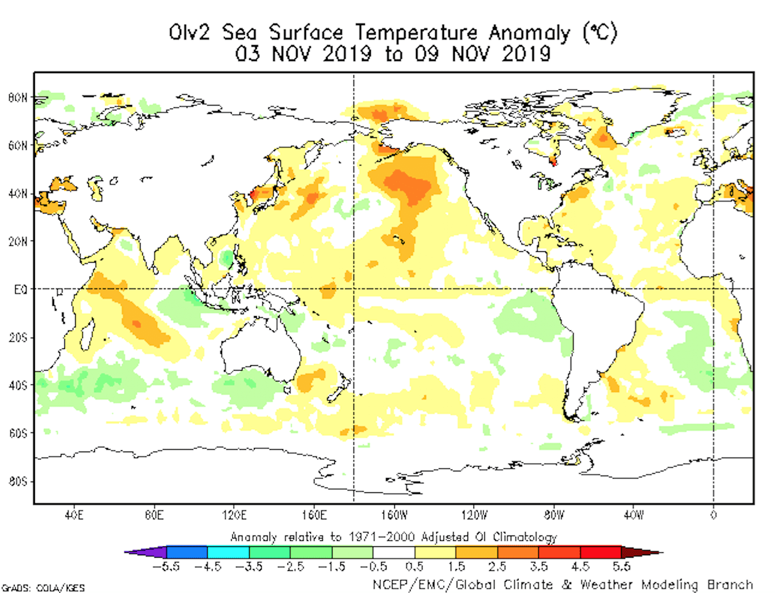
Sea surface temperature anomalies. You can clearly see the warm-cold dipole in the Indian Ocean, as well as warm waters around central tropical Pacific. This is likely to suppress convection over the Maritime Continent and possibly weaken the East Asian Winter Monsoon. Source: NCEP, NOAA.
The Indian Ocean Dipole (IOD) is at a near record high, meaning it’s warm in the west and chillier in the east. This dipole tends to break down during the northern hemisphere winter, but the positive IOD is so strong that it may suppress convection over the Maritime Continent well into the middle of the Japanese snow season.
Although we are amidst a neutral phase of the El Nino Southern Oscillation (ENSO), waters are warm over central parts of the tropical Pacific. This is more inline with an El Nino Modoki, and again, this is likely to pull convection away from the Maritime Continent to the detriment of Japanese snowfall.
Models & JMA nod in agreement
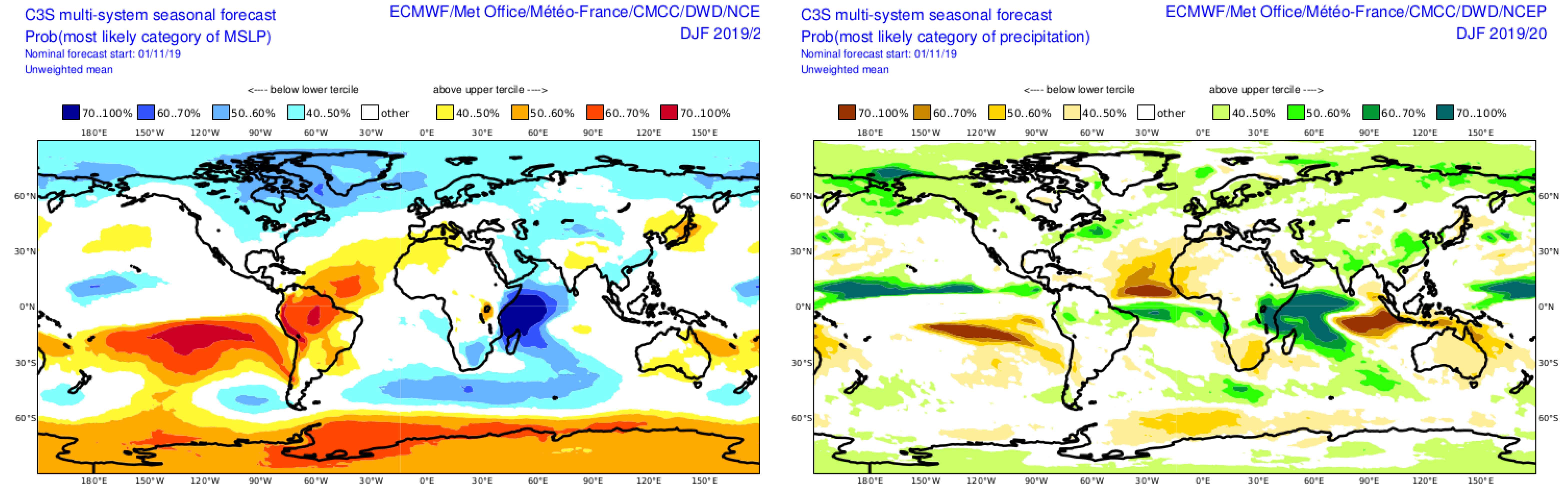
Unfortunately, climate models are all nodding their digital heads in agreement with this unfavourable outlook. Models splotch low pressure and lots of precipitation over the western Indian Ocean and central Pacific throughout the winter months, indicating all the action lays either side of the Maritime Continent. This in turn appears to weaken the EAWM where models also place high-pressure anomalies over Japan and suggest a weakened Siberian High.
The C3S super-duper model showing mean sea level pressure anomalies (left) and precipitation anomalies (right) for the winter months. High pressure over Japan and a weaker Siberian High suggest a weak East Asian Winter Monsoon this season. Source: Copernicus Climate Change Service
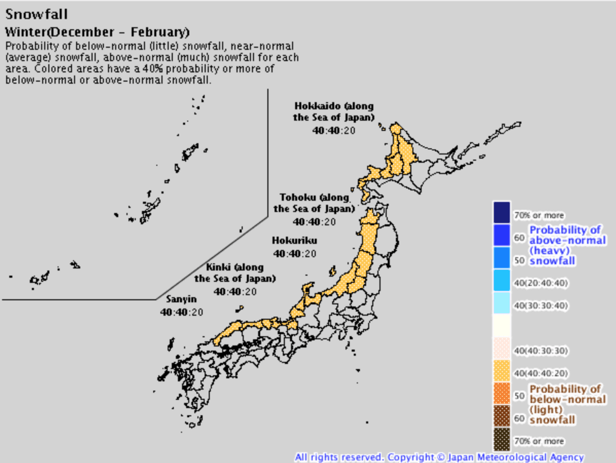
Folks at the Japanese Meteorological Agency (JMA) also concur by suggesting a heavy snow season is unlikely, but give an equal chance of average or below snowfall. They also forecast the first half of the season to be particularly slow for northern Honshu and Hokkaido.
The JMA think it’s unlikely we’ll see more Japow than usual, and give an equal chance for average or below snowfall. Source: JMA
Sea ice and snow cover may save our sashimi
A couple of things that may save our sashimi: there is plenty of snow cover over the Eurasian Continent and Arctic sea ice is low. In a roundabout way, both factors can contribute to more snowfall.
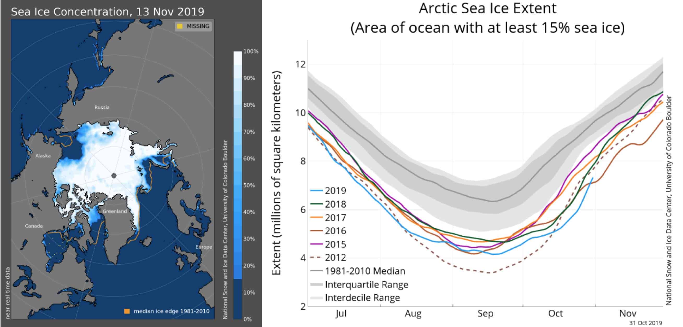
There’s less ice in the Arctic and that may continue through the winter months. This could lead to more/longer negative episodes of the Artic Oscillation, possibly resulting in more Japow. Also, above average autumn snow cover over the Eurasian Continent may have a similar result. Source: National Snow & Ice Data Centre
Whether or not this is picked up well by climate models is one thing, but it may lead to more negative episodes of the wily and harder-to-predict Arctic Oscillation, thus leaving the polar door open for cold outbreaks.
Average or below in an above average country
The majority of climate drivers and models indicate we’re likely to have average or below amounts of that magical Japow this season. But unlike this outlook, Japan is anything but average or below.
In a place where you usually see anywhere between 4m to 15m of the lightest, fluffiest snow on earth, an average or below season merely brings this hallowed place into the realm of mortals. Variation in snow amounts is often only felt at either end of the season.
Maintenant voici la mise à jour de décembre.
In the previous outlook I talked about how the strong positive Indian Ocean Dipole (IOD) and warm sea surface temperatures in the middle of the tropical Pacific were acting to suppress convection over the Maritime Continent (Indonesia, Malaysia & the Philippines), and how this is unlikely to be doing Japanese snowfall any favours.
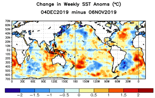
Change in sea surface temperature anomalies over the last month. The Indian Ocean Dipole has weakened and waters around the Maritime Continent have warmed significantly. Source: NOAA
Over the last month observations show this suppression of convection has waned, and climate models suggest it may reach near-normal levels sometime in the middle of the Japanese snow season.
This slide into a more favourable climate is due to both to the downward spiral of the IOD, which is also expected to dissipate in the middle of the season, along with significant warming of waters around the Maritime Continent.
In relation to all this, climate models show a pressure pattern that suggests the East Asia Winter Monsoon may strengthen to near normal levels during the second half of the season. This gives us better chances for the back half to pick up some of the slack of the first half.
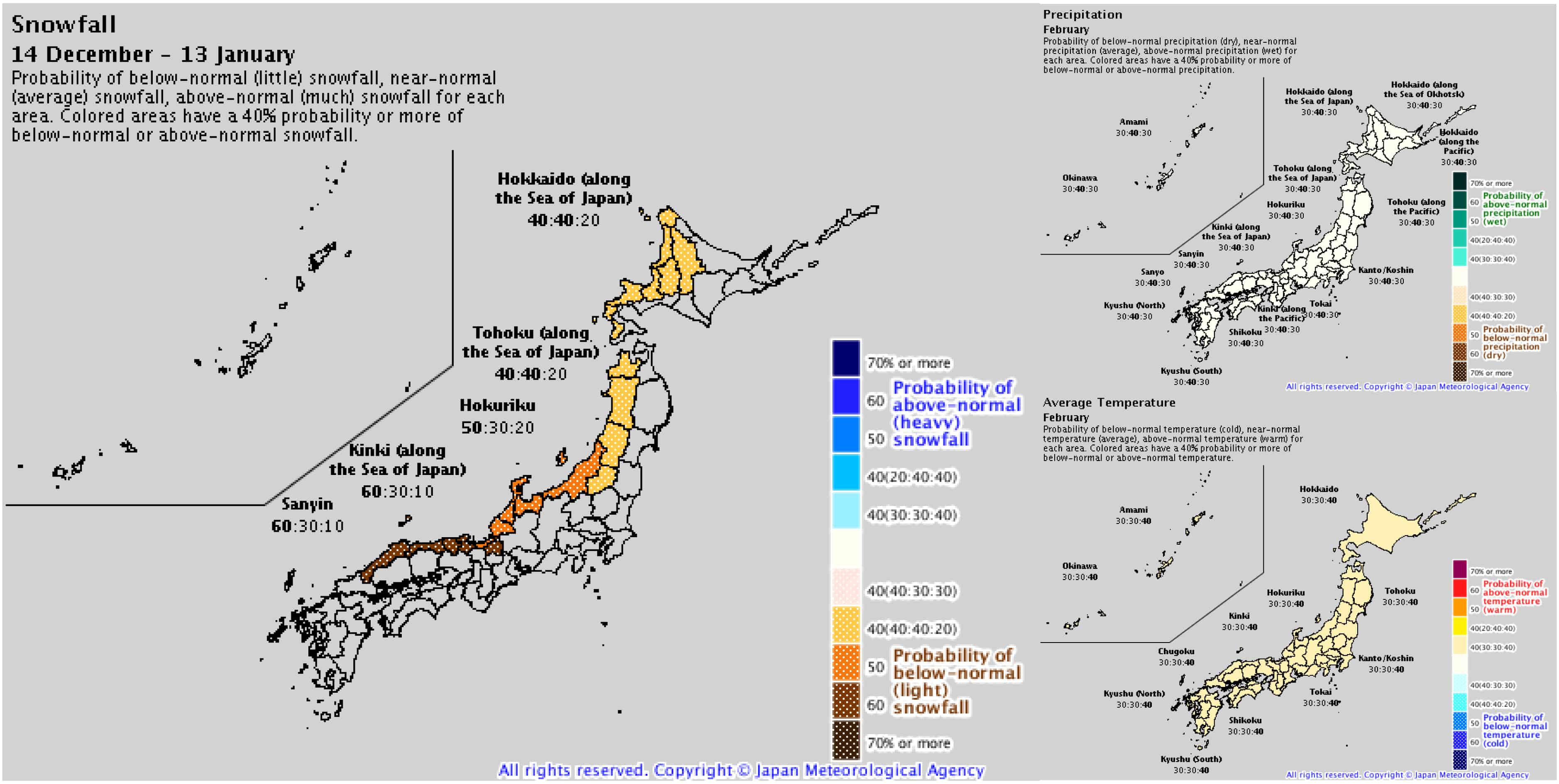
After a slow December and January, the JMA show healthier precipitation and temperature probabilities for February. Source: JMA
The Japanese Meteorological Agency (JMA) agrees with this. After a slow December and January, they show conditions may improve for February with a healthier outlook for precipitation and temperature probabilities.
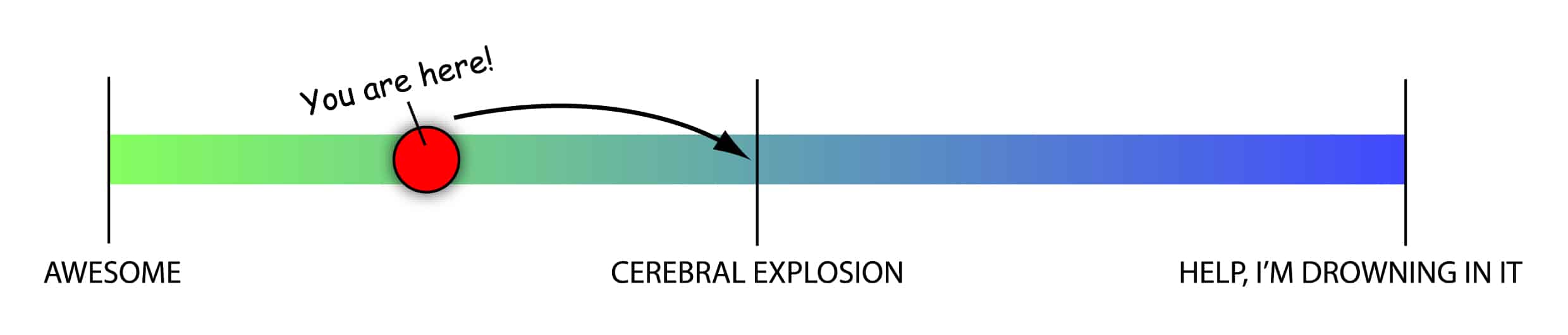
More-than-awesome to mind-blowing
While the first half of the season is slated to be slow by Japanese standards, we can expect to slide up the Japow Continuum as the season progresses. At this stage, the second half sits in the middle of this continuum where average snowfalls are most likely, with lesser but equal chances for above or below average snowfalls.
Here’s where we are and where we’re going on the Japow Continuum.
The climate drivers that I’ve talked about above may only account for a small portion of the overall variation in snowfall that we’ll see this season. We can still count on the Japow Machine to turn on at least once a week, with plenty of powder days to fill your boots and a steady rise in snow depths.
A slow first half will still be more-than-awesome compared to your typical Australian season, and an average second half will blow your mind. Any more than that and you might start having problems.
 ( (quelque part dans les bois d'Akakura Kanko)
 (quelque part dans les bois d'Akakura Kanko)

Commentaires