À la recherche de l'hiver
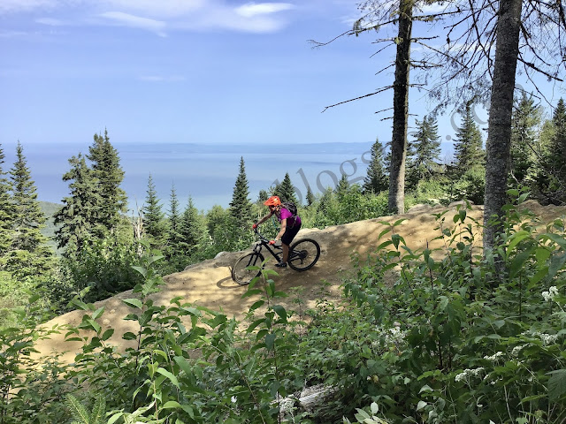
À l'Action de grâce ma blonde et moi somme partis sur la route à la recherche des premiers signes de l'hiver et nous les avons trouvés. Pour cette semaine notre territoire de chasse se situait entre Lachine et San Francisco et nous l'avons trouvé la neige. L'hiver tend à vouloir s'installer dans le Wyoming à Laramie pour être précis.


The winter of 2013/14 will bring plenty of snow to ski/snowboard resorts in both the West and East, though the West will get off to a much quicker start, as cold air gets established during November and December from the Rockies to the central Prairies.

Despite the milder temperatures during December and January, an active storm track will bring plenty of snow opportunities to ski country in eastern Canada, while mixed precipitation will be more common over southern Ontario.

Below is a breakdown of the forecast by region.......
The West Coast, including Vancouver, will have a changeable winter with drier-than-normal conditions for December before more typical winter storminess returns in January.
Temperatures will average close to normal for the first half of the winter then trend above normal for the second half of the season.
Snowfall along the Coast Range in British Columbia will be typical for an average winter with the greatest potential for heavy snowfall coming in January and early February.
--------
The winter will get off to a strong start across much of the Prairie region with shots of Arctic air being directed south from the Yukon Territory. This will result in increasing opportunities for accumulating snowfall over southern and western Alberta, including Calgary.
Average snowfall is expected for the central Prairies (Saskatoon) this winter, but below average for the eastern Prairies, including Winnipeg, especially the second half of the winter as a seasonably cold, but dry flow of air takes over.
--------
An active storm track through the Great Lakes during December and into a part of January will lead to above-normal precipitation this winter over a large portion of eastern Canada.
Snowfall will end up higher than normal from the upper Great Lakes through most of Quebec, including Montreal and up into Labrador. Farther south in Ontario, from Windsor to Toronto and Kingston, the milder pattern during December and January will lead to more mixed precipitation events, which will cut down on the potential for heavier snowfall.
Despite the increase in natural snowfall, snow-making in the eastern and Atlantic Canada resorts could be a challenge the first half of the winter due to the higher temperatures and humidity.
A drier, colder pattern is expected to take over in Ontario and western Quebec during February, as the storm track shifts toward the Maritimes and Newfoundland.
Due to the warmer start of winter in the East, lake-effect snowfall across the snow belts of Ontario will be lighter than usual for December and the first half of January before becoming heavier than normal for the second half of the winter, with more sustained invasions of Arctic air moving over the mostly unfrozen Great Lakes.
------
The combination of the prevailing storm track and above-normal sea surface temperatures will lead to a mild winter in the temperature department for Atlantic Canada.
December and January will be less stormy than usual from Halifax, NS, to Charlottetown, PEI, with a lack of Arctic air.
A pattern change by February will bring slightly colder air and more storms from Saint John, NB, to St. John's, Newfoundland.
-----
Long-Term Canadian Winter Trends To no surprise, Canadian winters have been trending warmer, especially since the 1970s. The greatest warming has been across the far north.
The Environment Canada graph below shows the long-term trend of national temperature departures since the late 1940s.
The winter of 2012/13 averaged 1.6 degrees C. above the 1961-1990 average, making last winter the 18th warmest in the 66-year record for the winter season in Canada.
The warmest winter on record for Canada was 2009-2010 followed by 2011-2012.
Merci de venir nous visiter !


C'est maintenant à nous de connaitre ce qu'Accuweather voit dans leur boule de cristal pour nous gens du Canada (GOD BLESS THE QUEEN)
Donc voici les prévisions et/ou prédictions météo pour l`'hiver 2013-2014, pour nous qui résidons dans le plus beau pays du monde (le Canada) qui par une série d’accommodements raisonnables inclus la belle province de pauvre (le Québec) depuis 1867.
The winter of 2013/14 will bring plenty of snow to ski/snowboard resorts in both the West and East, though the West will get off to a much quicker start, as cold air gets established during November and December from the Rockies to the central Prairies.

Despite the milder temperatures during December and January, an active storm track will bring plenty of snow opportunities to ski country in eastern Canada, while mixed precipitation will be more common over southern Ontario.

Below is a breakdown of the forecast by region.......
The West Coast, including Vancouver, will have a changeable winter with drier-than-normal conditions for December before more typical winter storminess returns in January.
Temperatures will average close to normal for the first half of the winter then trend above normal for the second half of the season.
Snowfall along the Coast Range in British Columbia will be typical for an average winter with the greatest potential for heavy snowfall coming in January and early February.
--------
The winter will get off to a strong start across much of the Prairie region with shots of Arctic air being directed south from the Yukon Territory. This will result in increasing opportunities for accumulating snowfall over southern and western Alberta, including Calgary.
Average snowfall is expected for the central Prairies (Saskatoon) this winter, but below average for the eastern Prairies, including Winnipeg, especially the second half of the winter as a seasonably cold, but dry flow of air takes over.
--------
An active storm track through the Great Lakes during December and into a part of January will lead to above-normal precipitation this winter over a large portion of eastern Canada.
Snowfall will end up higher than normal from the upper Great Lakes through most of Quebec, including Montreal and up into Labrador. Farther south in Ontario, from Windsor to Toronto and Kingston, the milder pattern during December and January will lead to more mixed precipitation events, which will cut down on the potential for heavier snowfall.
Despite the increase in natural snowfall, snow-making in the eastern and Atlantic Canada resorts could be a challenge the first half of the winter due to the higher temperatures and humidity.
A drier, colder pattern is expected to take over in Ontario and western Quebec during February, as the storm track shifts toward the Maritimes and Newfoundland.
Due to the warmer start of winter in the East, lake-effect snowfall across the snow belts of Ontario will be lighter than usual for December and the first half of January before becoming heavier than normal for the second half of the winter, with more sustained invasions of Arctic air moving over the mostly unfrozen Great Lakes.
------
The combination of the prevailing storm track and above-normal sea surface temperatures will lead to a mild winter in the temperature department for Atlantic Canada.
December and January will be less stormy than usual from Halifax, NS, to Charlottetown, PEI, with a lack of Arctic air.
A pattern change by February will bring slightly colder air and more storms from Saint John, NB, to St. John's, Newfoundland.
-----
Long-Term Canadian Winter Trends To no surprise, Canadian winters have been trending warmer, especially since the 1970s. The greatest warming has been across the far north.
The Environment Canada graph below shows the long-term trend of national temperature departures since the late 1940s.
The winter of 2012/13 averaged 1.6 degrees C. above the 1961-1990 average, making last winter the 18th warmest in the 66-year record for the winter season in Canada.
The warmest winter on record for Canada was 2009-2010 followed by 2011-2012.
Merci de venir nous visiter !
Commentaires