Winter is coming!
Cette semaine dans le tour de l'Amérique du nord en image je vous présente le Mount Baker.

On était sur les routes de la Colombie-Britannique en direction. On est passer à Banff , Rogers Pas, Revelstoke ... forcer d'admettre que l'hiver est loin d'avoir repris c'est droit. Ensuite on c'est diriger à Blaine dans l'état de Washington.

On est même passer à Steven Pass Wa à 1 km du sommet de la route on est tombée sur elle la neige.

Patience l'hiver finira bien par nous rejoindre. Sachez que Sunday River prévoit ouvrir lundi le 3 novembre.
Maintenant voici les prévisions météo concernant l'hiver 2014-2015 selon Accuweather pour nous qui vivons dans le plus beau pays du monde le Canada
.jpg)

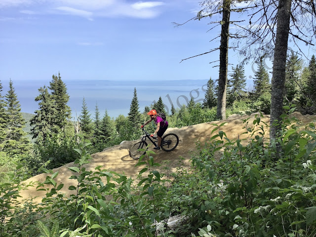
(Mount Baker Washington)
On était sur les routes de la Colombie-Britannique en direction. On est passer à Banff , Rogers Pas, Revelstoke ... forcer d'admettre que l'hiver est loin d'avoir repris c'est droit. Ensuite on c'est diriger à Blaine dans l'état de Washington.
(Près de Roger Pass B.C.)
On est même passer à Steven Pass Wa à 1 km du sommet de la route on est tombée sur elle la neige.
(Prise dans le stationnement de Steven Pass Wa)
Patience l'hiver finira bien par nous rejoindre. Sachez que Sunday River prévoit ouvrir lundi le 3 novembre.
Maintenant voici les prévisions météo concernant l'hiver 2014-2015 selon Accuweather pour nous qui vivons dans le plus beau pays du monde le Canada
The following are some of the comments that I wrote down as I prepared this forecast....
Increasing confidence that drier and milder conditions relative to normal will likely dominate this winter across British Columbia, especially during January and February. The winter will be rather placid in the Vancouver area with below-normal snowfall, while ski country in BC should get off to a solid start this winter in terms of snowfall before a drier pattern takes hold for the middle and later part of winter.
Despite the unusual September snowstorm, much southern and western Alberta, including Calgary will receive less snowfall than usual this winter with slightly-above normal temperatures. There are also indications that this upcoming winter could be windier than average.
Across the central Prairie region, including Regina and Saskatoon, average wintertime conditions can be expected with quick shots of dry, very cold air intermixed with periods of milder weather.
Invasions of Arctic air will tend be more directed into Manitoba and and northwest Ontario this winter, especially during January and February, but not nearly as harsh as last winter. The colder weather in January and February will suppress the the main storm track too far south and east and the result will be below-normal snowfall from Winnipeg, Manitoba through Thunder Bay and Sault Ste. Marie, Ontario.
After a mild start to the winter, much of southern and eastern Ontario, including Windsor and the greater Toronto area will end up averaging slightly colder than normal during from January to February, but not as cold as last winter.
In terms of snowfall, despite the milder December, there will be an increased opportunity for a couple of significant snowfall events during the month with an active storm track nearby. However, we expect less snowfall than usual for January and February, as the region generally remains a little too far north and west of the primary storm track.
There will be an abundance of storms this winter from southern Quebec through much of Atlantic Canada. This pattern will result in a higher probability for major snowfall events for locations such as Montreal and Quebec City on eastward toward Moncton, New Brunswick.
Skiers and snowmobilers across eastern Canada should expect fairly typical winter conditions overall, but with the reduced threat for sustained, bitter cold especially from the eastern Great lakes to Quebec.
Despite the stormy outlook, areas from Nova Scotia to Newfoundland, including Halifax and St. John's will escape the worst of winter's cold thanks to a combination of increased cloud cover, prevailing winds and above-normal surface water temperatures. Even though temperatures will be milder this winter, seasonal snowfall will still end up above-average over much of the region due to the higher potential for large storms that produce heavy, wet snow.
----
On s'en reparle à la fin de l'hiver mais d'ici là une chose à retenir El Nino
Merci de venir nous visiter
Commentaires